2024 Satellite Design Competition: Earth Observation and Freedom from Tyranny

The report will provide:
- Identification of characteristic actions by dominating states that would be observable by optical and radar satellites.
- Discussion of the challenges and principles of developing software algorithms to ingest and analyze the optical and radar images to identify these actions.
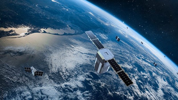
- A basic design of low-cost, high-performance imaging satellites operating in LEO that can observe the characteristics.
- Definition of the number of satellites and their orbits required to provide global coverage and a revisit rate necessary to produce useful results.
- Launch plan for placing the required satellites in orbit.
- Ground stations required for data download, edge processing (to reduce the fiber transmission volume) and transmission to central control (using a ground-segment-as-a-service vendor).
The intention of this project is to introduce you to the fundamentals of earth observation and the growing capability to automate image analysis to quickly produce meaningful results. It is not meant to require coding skills or software development expertise.
Project Specifications
- Through research and team brainstorming, define characteristics observable from Earth orbit that reveal efforts to dominate or conquer other states. These may include:
- Detection of construction along disputed borders
- Changes to shared natural resources (such as damming a river)
- The massing or movement of armed forces
- Population movement in response to intimidation or violence.
- Research the fundamentals of earth observation including:
- Orbits and their specific uses (e.g., sun-synchronous orbits that ensure the surface is illuminated by the sun at the same angle during every “pass” over the site)
- The resolutions currently captured by EO satellites and what they are capable of capturing
- The typical applications for optical, synthetic aperture radar and hyperspectral imaging in EO.
- Research the fundamentals of data analytics of EO images and the challenges of machine interpretation of optical and other images of the same location over multiple passes. The goal is not to become an expert in AI image analysis but to be able, in the report, to discuss the current state of the art and its ability or inability to detect the characteristics required.
- Research existing EO constellations and use this information to develop the design for a low-cost imaging satellite operating in LEO that is capable of capturing images of sufficient resolution to detect the required characteristics.
- Define a constellation of such satellites, their total number and orbits required to provide global coverage and suitable revisit rate.
- Based on information on current launch vehicles and their capacity – SpaceX, Rocket Lab, Vega, etc. – estimate the number of launches required to put the constellation in orbit and a probably cadence of such launches.
- Define the ground stations required for data download, edge processing and transmission to a central site based on the availability of ground-segment-as-a-service providers such as Atlas Space, KSAT, neXAT, RBC Signals, CM Technology and Swedish Space Corporation.
Team Specifications
Teams must be comprised entirely of students at one university. Teams will be limited to one per university, and team candidacy must be submitted through that university's SEDS chapter. We recommend between 3 and 10 members per team, but we encourage team leadership to include as many interested chapter members as possible. Individual team members must maintain student status at the university naming the team and may only contribute to one project at a time.
Since this is a student project, SSPI and SEDS expect student team members to do the vast majority of the work. Mentors are assigned to assist teams with overcoming the learning curve, but should not do substantial work on the project.


